top of page
TARA JOHNSTON | C3501066
DISPLACE_NONPLACE
CAPE CORAL | FLORIDA
[1]: INTRODUCTION
Displace_Nonplace is set in Cape Coral, Florida, USA.
Founded in 1957, Cape Coral was sold as a "Waterfront Wonderland" by the Rosen brothers, developers and salesmen credited with inventing the infomercial. Redfish Point, as it was formally known, was previously marshlands which the Rosen Brothers drained to pave the way for the paradise they hoped to peddle. Today, Cape Coral has developed greatly and has a population of approximately 200,000 people, many of whom choose to live seasonally ('Snowbirds').
In September 2022, Hurricane Ian made landfall in Cape Coral and was classed as Category 5. The result of this was significant damage to the city as a whole, particularly due to the lack of urban strategy by the Rosen brothers and removal of storm-mitigating environmental elements.
As a studio, we gathered research on individual aspects of Cape Coral and collated our research on a website:
https://nonplace2022.wixsite.com/non-place-2022


[Interactive]

Website Contribution: Police & Media
Cape Coral, Florida, USA


[2]: RESEARCH: PLACE_NON PLACE


Ecosystems & Ecosystem Destruction
Much like the migratory 'snowbirds' who come to live seasonally, Cape Coral is home to many species of migratory and non-migratory birds, in addition to urban, marine and preserve species. There are also a number of vegetative species, such as mangroves, which create a unique ecosystem due to their storm mitigating abilities. Though there are small pockets of Cape Coral which are still home to mangroves, the majority were removed during the development of the city, which has destroyed habitats and made the city more susceptible to storm damage.


Ecosystem Destruction
Cape Coral has been particularly affected by Algae growth for approximately a decade. Due to the 400 miles of canals spanning the city, algae which forms in one area can quickly spread through the connected parts of the waterway system. Blue-green Algae, the prominent species in Cape Coral, is highly invasive and poses danger to humans and animals. Over the last few years a company (Solitude Waste Management) have sought to remove the algae, though the process is expensive and can have additional adverse affects to the water, due to the chemical porcesses.


Ecosystem Destruction
Cape Coral was originally home to mangrove trees which spanned the site, particularly along the coastal edges and into forestland. Now, mangroves are typically found exclusively on the coast and in wildlife preserves, as most were cut down the facilitate the development of the city in the late 1950s. As the topography was also flattened in the process, many natural storm mitigating properties no longer exist. Therefore, when a storm or hurricane does hit, it will cause much greater damage.
In the case of Cape Coral, it will also cause algae to move through the canals, fuelled by the chemical run-offs from agricultural fields in the north, causing significant damage to already endangered wildlife and ecosystems in and around the city.
[3]: DEFINING PLACE & NON PLACE


NON-PLACE

PLACE


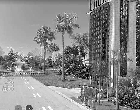
NONPLACE | Four Mile Ecological Preserve


PLACE | Matlacha Wildlife Reserve / Cape Royal Golf Club


Place_Nonplace
What defines a 'Place' and a 'Nonplace'?
Personal Definitions:
Place - A space which an individual has given deeper meaning, whether through a historic or social connection, typically formed by use of the space.
Nonplace - A space which has lost connection to the meaning it originally had, intended to have, was given by an individual or never had. Somewhere which lacks the purpose, function and symbolism to provide depth in the eyes of an individual. It is possible that a space may lose this depth through the individual no longer connecting with the space.


Concept of Place:
Golf Courses as the Contemporary Agora
Much like the Ancient Agora of Athens, the golf course today offers a business-related and political forum for like-minded inidividuals. In Cape Coral, there are multiple golf courses. The Cape Royal Golf Course, on the western edge of the city, sits juxtaposed to the Matlacha Wildlife Reserve, and has an interspersion of private housing along the course. Unlike Athens, golf courses in Cape Coral are typically located on the outskirts and edges of the city, in exclusive areas where only some inhabitants of the city have access.
Cape Coral's typical demographic is White American Males over the age of 45. As Floridian political data shows, this demographic typically votes Republican, the conservative-leaning political party. Therefore, these citizens believe they have similar values and are of equal footing, in the same way the ciizens of Ancient Athens did. Thus, it is likely that the discourse and democratic procedures have a similar outcome to that of the Agora.

Concept of Place:
The Agora
As J.B Jackson discussed in 'The Word Itself', the Agora was an ancient Greek concept originating in Athens. Defined as a public space where citizens of equal footing could meet to discuss philosophy and politics, it often existed by important landmarks and way-finding points, such as temples, markets and workshops. Many modern democratic procedures were formed and discussed during this time, including the rights of the individual and equal citizenship.
Despite this, recent studies have found that it may not have been as equal and democratic as J.B Jackson suggests as women, slaves and non-Athenians were often excluded from democratic discourse and only a very small percentage of the population were able to vote.
Voter Diagram Credit: Maryam Najeeb
https://nonplace2022.wixsite.com/non-place-2022
[4]: 2.5 D MODEL - REPRESENTATING PLACE_NONPLACE


1/9
Model Development
The initial concept for the model was to draw inspiration from Cape Coral's history. As the Rosen Brothers heavily marketed the development, the iterative model takes on the appearance of postcards with multiple layers, each representing an element of Cape Coral which defines a sense of Place or Nonplace.
From the Nonplace postcard, the layer and reading quotes would be suspended, to represent how this particular layer removes the sense of place.

The research into the Four Mile Ecological Preserve revealed the layer in question: Humans.
The forced inhabitation of humans in the park has caused multiple ecological problems, including the removal of Mangroves, animals leaving their habitats and pollution from littering in the park and ocean.


1/3
Final Model
As the model developed and became more structural, it was difficult to create a 3D perspective from the acetate. I created a frame from wood, CNC routed slots to allow for removable layers (representing how the culmination of these layers creates a sense of place / nonplace) and put the frames on stands. This development moved the concept from the inspiration of postcards to tourist information bulletin boards that can be found outside both the Place Reserve and Nonplace Reserve.
Using pins and string, I visually connected the layers that were similar (eg. human connection / lack of human connection) to convery that although both spaces contain similar concepts, those concepts define the sense of place/placelessness different depending on context. This element was later removed, to allow the layers to blend and show just how similar they actually are.
Final model - Shadow Tests
Much like the migratory 'snowbirds' who come to live seasonally, Cape Coral is home to many species of migratory and non-migratory birds, in addition to urban, marine and preserve species. There are also a number of vegetative species, such as mangroves, which create a unique ecosystem due to their storm mitigating abilities. Though there are small pockets of Cape Coral which are still home to mangroves, the majority were removed during the development of the city, which has destroyed habitats and made the city more susceptible to storm damage.


1/1
Final model - Large Scale Projections

[5]: REIMAGING_REIMAGINING
PHASE 1: COLLABORATIVE GROUP WORK

Phase 1
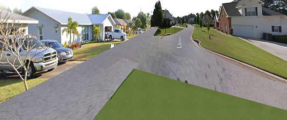
For the next phase of the project, we were asked to work in small groups with a given site and precedents. Site 4 sits with Del Prado Boulevard running vertically through the centre of the site and Veteran's Parkway horizontally, linking Cape Coral to Fort Myers.
Our group decided to split the site horizontally and each of us look into three precedents each. The precedents I looked into were considered 'Movement Spaces': Turia River Park (Valencia), Corso Vittorio Emmanuele II (Turin) and Avenida 9 Julio (Buenos Aires).
The initial task was to compare and understand the differences in scale compared with our site in Cape Coral.


Initial Research
The initial task allowed us both to understand our sites in depth. We eplored key aspects, then began to investigate in further detail. To help each other understand our inidividual sites, we collected our research on a MIRO board.

Contribution: Tara

Contribution: Asmaa

MIRO
We used a MIRO board to collate our research. Together we examined Cape Coral and our precedents and began to look at Aerial, Plan and Street views of the sites.
From this research, we began to investigate differences in scale and superimposition of elements to help explain these findings.


MIRO
Examinations of scale and layering systems that create systems of movement.


MIRO
Superimpositions of elements over Cape Coral exploring scale, and layering differences.


PHASE 2: EXPANDED GROUP WORK

Next Brief
Once we had produced research for our site, the brief was expanded to include the sites surrounding ours. We were asked to collaborate again to produce a masterplan for Cape Coral, using only superimposed elements from the Precedents.


Group Masterplan
First we printed a large map of Cape Coral and discussed our individual findings. We began to plot systems we believed were essential to our sites, then discussed how to interconnect these elements in a cohesive way. It also brought up new queries we had about each of the sites and as a whole. Together we worked on a draft solution which we developed into a formal masterplan using superimposed elements we felt were beneficial to the scheme, from the precedents.
Contribution: Tara, Asmaa, Maryam, Sobaan, Johan, Haydn, Supriya


Design Contribution: Tara, Asmaa, Maryam, Sobaan, Johan, Haydn, Supriya
Visual Contribution: Tara, Maryam
Group Masterplan
As we formalised the plan, we began to explore how these elements would benefit the site and what we hoped for Cape Coral to achieve.
We then began to break down this plan into what we believed would be reasonable phases if the scheme were to be implemented over time, exploring how the systems of movement would take precedence due to the infrastructure works needed, then offsetting this work by re-wilding of the canals. The final phase would be the implementation of facilities and green spaces to support Cape Coral.

Phase 1
Phase 2


Phase 3


Contribution: Tara
Contribution: Tara


Contribution: Tara


Contribution: Tara


Contribution: Tara


Contribution: Maryam

Contribution: Maryam


Contribution: Haydn
Contribution: Asmaa


Contribution: Supriya


Contribution: Haydn

Contribution: Supriya


Contribution: Sobaan

Contribution: Sobaan
Contribution: Johan
[6]: PURPOSE_FUNCTION_USE


DEFINING & DETERMINING PURPOSE_FUNCTION_USE
Purpose_Function_Use
Having completed studies into our combined sites, we moved back into researching for our individual projects.
Maryam and I recognised that we were looking at similar themes and issues, and that our chosen sites were in close proximity. We decided that it could be beneficial to link our projects.
Our individual projects will therefore focus on our chosen sites, however we will also have connections through shared programmes, users and a narrative journey from one site to the other.

Contribution: Tara & Maryam
SITE ANALYSIS | SITE A: TARA

Missing Components...
- Further information into algae as a biofuel to power the potential architecture - taken from technology unit
- Mapping showing presumed algae spread before and after hurricane
- Further detail about mangroves and how biomimicry could apply to design
- Narrative journey exploration in further detail
- Detailed breakdown of purpose, function & use
bottom of page